Back Country Tracks
Our Back Country roads have reopened. Please note that these roads are only suitable for 4WD vehicles and drivers should take care and drive to the conditions. Old Dunstan Road from Totara Creek to Linnburn Runs Road is still closed until further notice.
Central Otago District Council maintains around 400km of back country tracks, primarily used for farm and recreational access. These dry-weather roads cross rugged terrain and are not maintained in winter due to harsh conditions. A suitable vehicle and advanced driving skills are essential, especially during or after bad weather. With low traffic volumes and high maintenance costs, grading is infrequent, and surfaces are often rough.
Back Country Road Closures
Each winter, Central Otago District Council closes several high-country roads to protect them from vehicle damage in the harsh winter conditions.
The below may change depending on conditions. For accurate updates see the Temporary Road Closure page
The following roads are closed from the Tuesday after King's Birthday weekend until further notice:
- Lake Onslow Road from Linnburn Runs Road to the boundary gate at Lake Onslow. To see the map click here
- Old Dunstan Road Track from Paerau Road to Dunedin City Council boundary. To see the map click here
- Nevis Road from Commissioners Creek to the Southland District Council boundary. To see the map click here
- Bridge Huts Road from Bridge 185. To see the map click here
- Upper Manorburn Dam Road from the intersection with Aston Road. To see the map click here
- Old Dunstan Road from Poolburn Dam to Totara Creek. To see the map click here
- Mount Buster Road from the airstrip access to the DoC boundary and Little Kyeburn Road from the stockyard gate. To see the map click here
- Serpentine Road from Linnburn Runs Road to Lake Onslow Road. To see the map click here
- Linnburn Runs Road (Blackball) between Loganburn Ford Road and Puketoi Runs Road. To see the map click here
- Long Valley Ridge Road from Old Dunstan Road to Serpentine Road. To see the map click here
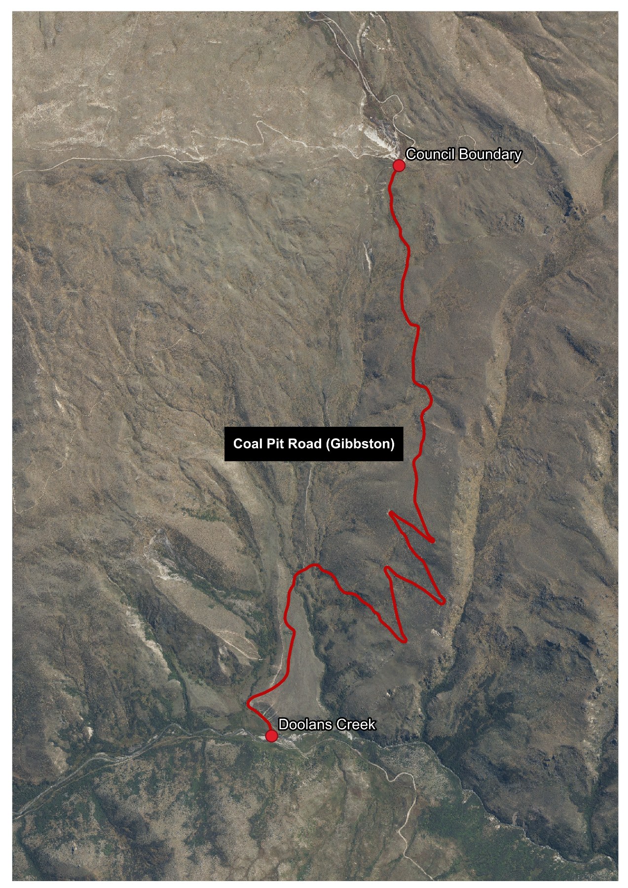
- Coal Pit Road, from QLDC district boundary to Doolans Creek. To see the map click here
An overview map of the combined Serpentine Area is available. To see the map click here
The following road is closed from the Tuesday after King's Birthday weekend to 30 October:
- Old Dunstan Road from Totara Creek to Linnburn Runs Road. To see the map click here
Note: The Poolburn Dam is accessible from the Poolburn/Moa Creek side.
The roads are legally closed under Section 342 (1)(b) of the Local Government Act 1974 and Clause 13 of the Tenth Schedule, which allow Council to temporarily close and prohibit ordinary vehicular traffic.